Seven Rila Lakes hiking guide: routes, conditions, and how to get there from Sofia
From Sofia: The Seven Rila Lakes Full-Day Hiking Tour
How do you get to the Seven Rila Lakes from Sofia?
By car: drive south on the A3 motorway toward Samokov, then follow signs to Panichishte village — about 1h45m. By public transport: bus from Sofia's Avtogara Yug to Samokov, then a local bus to Panichishte (3–4 hours total, multiple changes). Most visitors take an organised day tour from Sofia, which handles transport and gives you a guide.
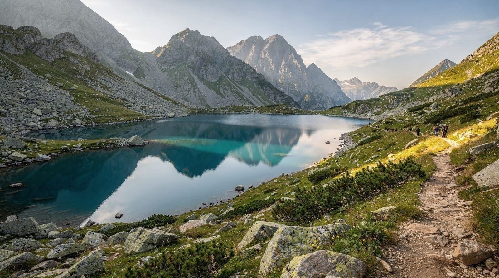
The Seven Rila Lakes sit between 2095m and 2535m in the Rila Mountains, 100km south of Sofia. They are seven glacial lakes arranged on a staircase of cirques carved during the last ice age, each with a descriptive Bulgarian name that refers to its shape or character. The hike connecting all seven is one of the most popular mountain walks in Bulgaria — well-marked, achievable in a day without technical skills, and visually distinctive from anything else the country offers. This guide covers the practical logistics: how to arrive, what the trail involves, what the lakes actually look like, and how to make a day of it without getting caught out by altitude weather.
Getting there from Sofia
By car
The most flexible option. Drive south from Sofia on the A3 motorway toward Plovdiv, exit at Samokov, then follow road signs to Panichishte village. The gondola base station is at the upper end of the village with a free car park. Total distance: approximately 100km. Driving time: 1h45m in normal conditions. The road from Samokov to Panichishte climbs into the mountains and has sharp bends in the final section; take it at a measured pace.
Parking at the gondola base fills up by 9am on peak summer weekends. Arriving before 8am secures a spot without difficulty.
By public transport
From Sofia’s Avtogara Yug (South Bus Terminal), take a bus to Samokov. From Samokov, a local bus or shared taxi connects to Panichishte. The total journey takes 3–4 hours with at least one change. Bus frequency to Panichishte is limited, and the last return bus can be early — check the schedule carefully before departing. This route is feasible but requires accurate timetable research and leaves little margin for delays.
By organised day tour
The majority of visitors from Sofia arrive by organised tour. A guided day trip typically includes hotel pickup, return transport, a guide for the hike, and a stop at an additional site (often Rila Monastery or the thermal pools at Sapareva Banya). It removes the logistical challenges of public transport and gondola timing, and a guide’s knowledge of the lakes adds context that is hard to replicate from a map.
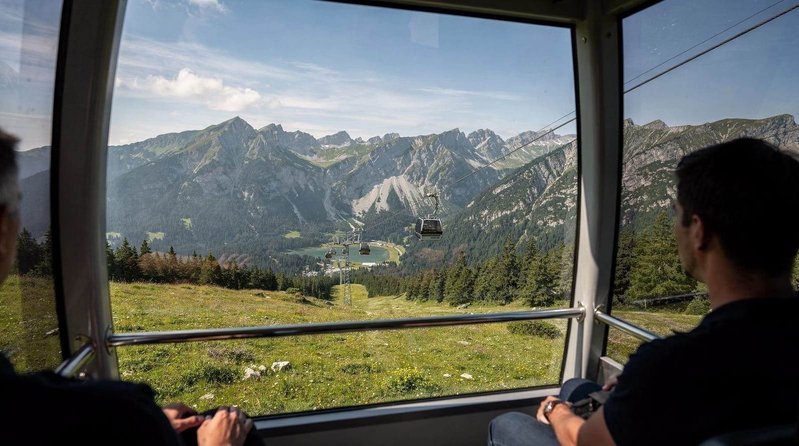
GetYourGuideFrom Sofia: The Seven Rila Lakes Full-Day Hiking TourCheck availability →The Panichishte gondola
The gondola base station sits at around 1400m in Panichishte. The gondola lifts you to approximately 2100m — about the altitude of the lowest lake — in under 15 minutes. Without it, reaching the lakes requires a 4-hour hike from the village.
Seasonal operation: The gondola typically runs from July through September. In favourable years, it opens in late June; in difficult snow years, July. It does not operate in winter, spring, or late autumn. Always confirm the current operating status via the resort’s website or by calling ahead — the schedule changes annually and is not reliably reflected in older travel articles.
Operating hours: Usually 8:00–17:00 in peak season, with the last descent typically at 17:30. If you are aiming to see all seven lakes, take an early gondola (before 9am) to have adequate time and avoid midday crowds.
Gondola cost: Tickets are purchased at the base station. In 2026, expect to pay in the €10–15 range for a return ticket; prices have increased since Bulgaria’s adoption of the euro in January 2026.
Crowds: The gondola creates a bottleneck on summer weekends. If you arrive after 10am in July or August, you may wait 30–45 minutes for a gondola cabin. An early start resolves this.
The seven lakes — lowest to highest
Each lake has a Bulgarian name describing its shape or a characteristic feature. From lowest to highest:
1. Dolnoto (The Lower) — 2095m The largest of the seven by surface area and the first you encounter after the gondola drop-off. The path around its eastern shore is broad and used by virtually all visitors. In July, the lake’s surface is clear and deep blue.
2. Ribnoto (The Fish) — 2182m The second lake, above Dolnoto on the southwest side. Named for the trout that historically populated it. The path from Dolnoto to Ribnoto climbs a short rocky section.
3. Trilistnika (The Trefoil) — 2216m The third lake is the smallest and most irregularly shaped, resembling a three-lobed leaf from above. The path between the second and third lakes crosses open alpine terrain.
4. Bliznaka (The Twin) — 2238m The widest lake, divided by an isthmus of rock that gives it a twin-basin appearance from certain angles. The altitude here starts to be noticeable — short of breath is normal.
5. Babreka (The Kidney) — 2282m Named for its kidney shape. The fifth lake is surrounded by steep rocky slopes and feels considerably more remote than the lower four.
6. Okoto (The Eye) — 2440m The deepest lake at 37.5 metres. Its near-circular shape and dark blue depth give it a striking appearance in summer when ice has fully melted. The steep section between Babreka and Okoto is one of the more demanding parts of the trail — use care on loose rock.
7. Salzata (The Tear) — 2535m The highest lake and the smallest. It sits in a high cirque and is often partially frozen into July. The view from the lip of the cirque south toward the main Rila ridge is the highest point most day hikers reach on this loop. From here you descend back through all lower lakes to the gondola station.
GetYourGuideSeven Rila Lakes Hiking Day-Tour from SofiaCheck availability →The hiking loop
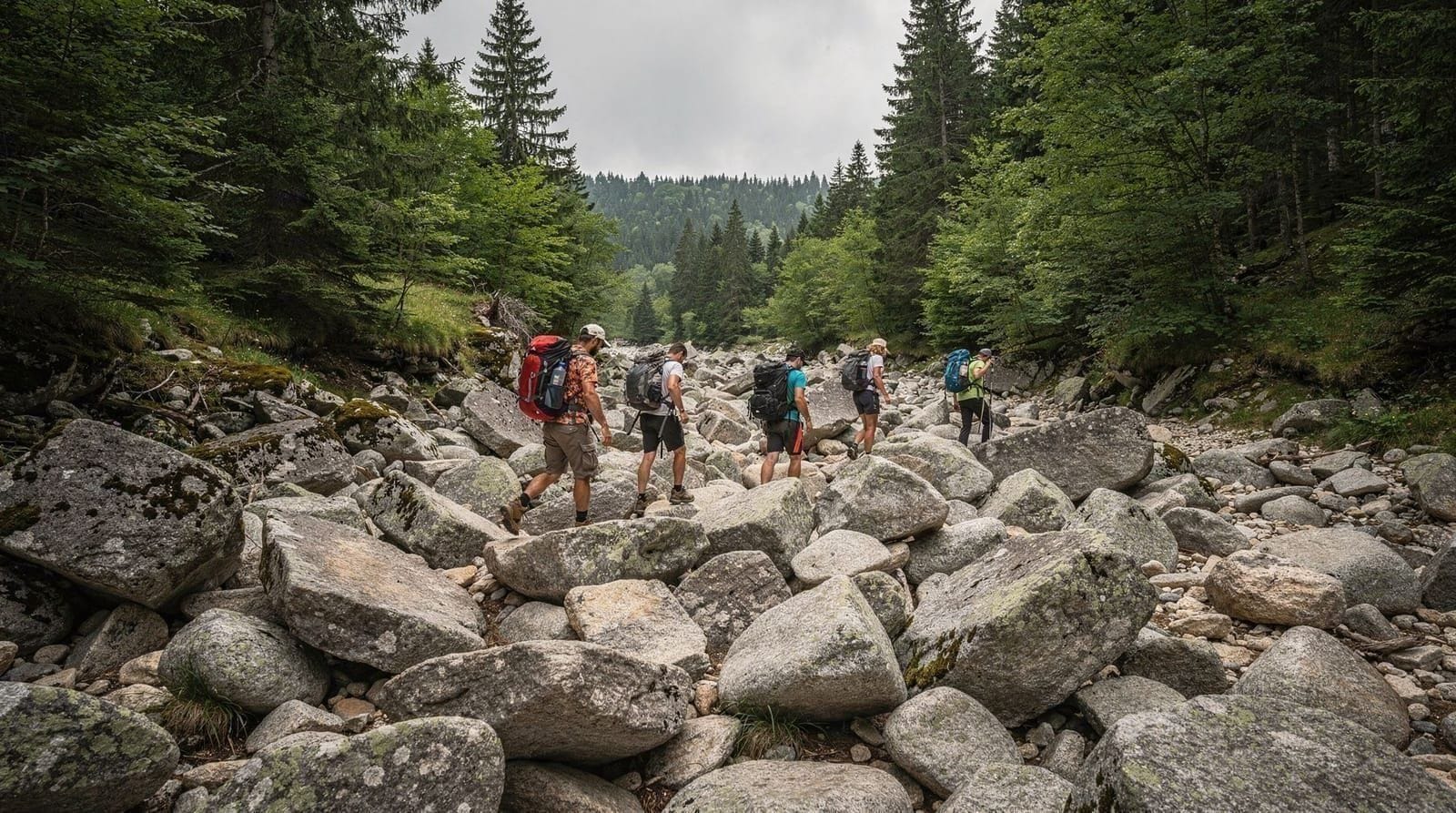
The standard circuit visits all seven lakes in order, ascending from the gondola top station to Salzata and returning by the same route (or via a variation through the saddle south of Okoto). Total distance of the loop from gondola top to Salzata and back is approximately 8–10 km, with around 400m of additional elevation gain above the gondola drop-off. Most hikers complete it in 4–5 hours, not counting breaks.
The trail is marked with painted rocks and metal posts. Navigation errors are rare in clear weather. In low visibility (fog is common in the afternoon), the markers are still usually findable, but a downloaded offline map on your phone provides important backup. Mapy.cz covers the Rila Mountains with accurate trail data.
Key sections to watch:
- The ascent from Babreka (5th lake) to Okoto (6th lake) involves steep, rocky terrain. Poles are helpful on this section.
- The descent from Okoto back toward Bliznaka requires care on loose stone — this is where most ankle injuries occur.
- Weather can deteriorate rapidly above 2400m. If you see cumulus clouds building over the ridge to the south, start descending immediately rather than pressing to the highest lake.
Difficulty and fitness
The Seven Rila Lakes loop is classified as moderate, though the altitude makes it feel more demanding than a similar hike at lower elevation. The factors that catch people off-guard:
Altitude: You are working at 2100–2535m. Even fit people who do not regularly hike at altitude may notice reduced aerobic capacity. This normalises within an hour or two. Altitude sickness in the clinical sense is uncommon at these elevations but not impossible if you have ascended rapidly from sea level in the past 24 hours.
Weather: Mountain weather in the Rila range changes faster than most visitors expect. Clear mornings frequently see afternoon thunderstorms build over the ridges. Starting the hike by 8am and aiming to complete the upper lakes by 1pm gives you a workable safety margin.
Terrain: The trail above Ribnoto is rocky throughout. It is not technical — no climbing is involved — but it is uneven underfoot. Trail runners or flat-soled shoes significantly increase the risk of a rolled ankle on the upper sections.
What to wear and bring
Footwear: Ankle-supporting hiking boots, broken-in rather than new. The upper lakes section is too rocky for trail runners to be comfortable or safe.
Clothing: Three layers minimum even in July. Start in a base layer; add a fleece or light down for breaks and above 2400m. Pack a waterproof shell — it should always be accessible, not buried at the bottom of your bag. Summit temperatures in July average 12–15°C on clear days but can drop to 5°C or below if a front arrives.
Water: Carry 2–3 litres per person. There are no drinking water points on the trail above the gondola station. The lakes themselves are protected glacial reserves — no swimming, no filling of water bottles from them.
Food: Bring enough for a full day. The gondola base station has a café and small shops. Above the gondola, there is nothing available until you return to Rila Lakes hut (basic snacks and drinks) near the lower lakes.
Sun protection: UV radiation at 2500m is significantly higher than at sea level. Factor 50 sunscreen, polarised sunglasses, and a hat are important — reflected UV from snow or water compounds the exposure.
Trekking poles: Optional but useful. Particularly helpful on the descent from the upper lakes for knee support.
GetYourGuideFrom Sofia: 7 Rila Lakes Hiking & Thermal Spa Day TourCheck availability →Staying at the Rila Lakes hut
Rila Lakes hut (Хижа Рилски езера) sits at approximately 2200m near the lower lakes. It offers dormitory accommodation and a basic canteen serving warm meals and drinks. For July and August, book at least 2–3 weeks in advance — the hut is popular with Bulgarian hikers who come for multi-day routes in the Rila range.
Staying overnight allows you to experience the lakes without gondola crowds: the light on the water at dawn or at sunset is considerably different from the midday experience most day visitors have. The hut does not offer private rooms; if you require one, enquire well in advance about any reserved spaces.
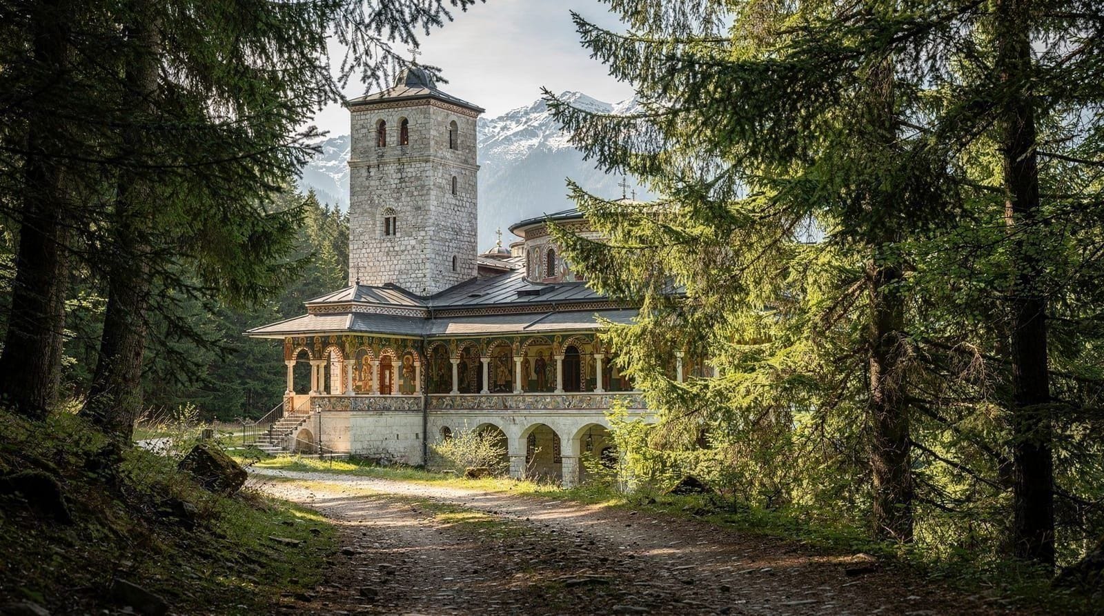
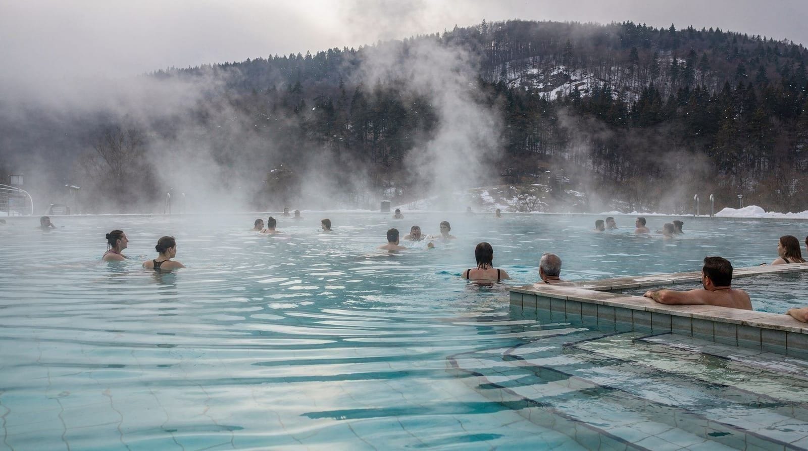
Combining with Rila Monastery and Sapareva Banya
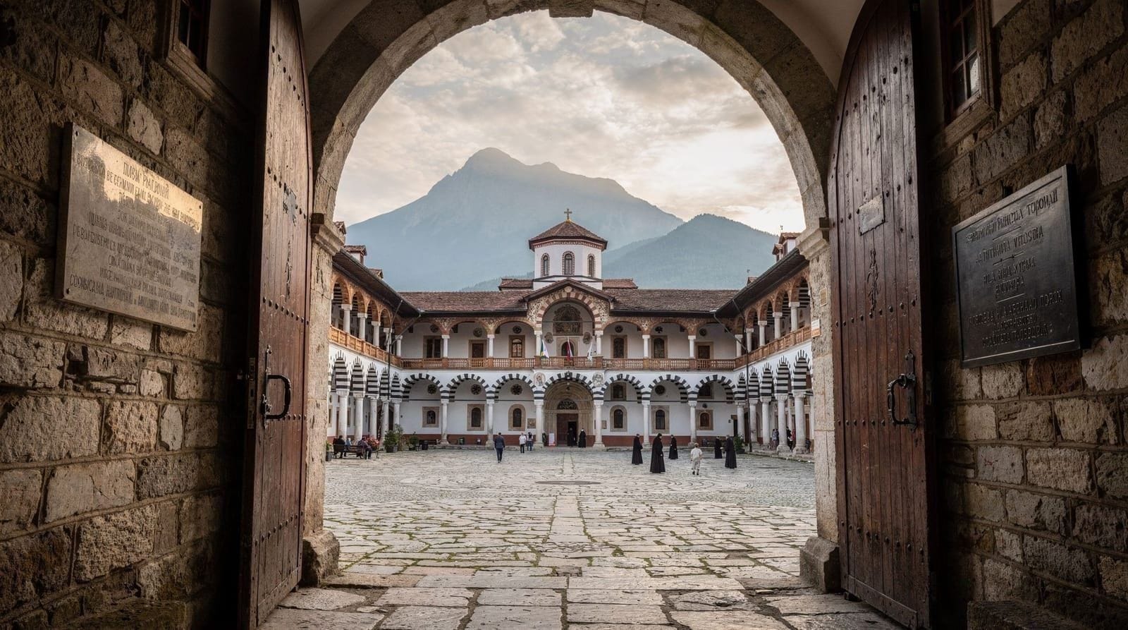
Rila Monastery
Rila Monastery is 30 minutes by car from Panichishte along a mountain road. Combining the lake hike with a monastery visit makes for a long but viable day (12–13 hours total), particularly if you have a car and take the first gondola. Descend from the lakes by 1:30pm, drive to the monastery for a 2-hour visit, and return to Sofia in the early evening. See the Rila Monastery day trip guide for what to see and how long to allow.
Sapareva Banya
Sapareva Banya is 15km from Panichishte and is home to Bulgaria’s only geyser and a series of thermal pool complexes. After a full day hiking at altitude, 2–3 hours in a thermal pool is genuinely restorative rather than just a tourist checkbox. The town has several pool facilities with day-use rates; the largest are on the southern edge of the settlement. See the hot springs in Bulgaria guide for a comparison of the main options.
Planning your day
A workable timeline for a July day with the gondola:
- 6:30am: Depart Sofia by car
- 8:15am: Arrive Panichishte, park, buy gondola tickets
- 8:30am: First gondola up
- 8:45am: Begin hiking from top station
- 12:30pm: Reach Salzata (7th lake), rest, descend begins
- 2:30pm: Back at gondola top station
- 3:00pm: Gondola down
- 3:30pm – 5:30pm: Drive to Rila Monastery or Sapareva Banya
- 7:30pm: Return to Sofia
This schedule requires an early start but is not rushed. If you skip the Monastery or Sapareva Banya, you are back in Sofia by 6pm comfortably.
See day trips from Sofia for how this compares with other full-day excursions, and Sofia itinerary planning for working it into a multi-day visit. If you are also planning to hike Vitosha Mountain, spread the two hikes across different days — both are more enjoyable with fresh legs.
For more hiking options in the region, the Rila Mountains hiking guide covers longer routes and multi-day options in the same range.
Frequently asked questions about Seven Rila Lakes hiking guide
How far are the Seven Rila Lakes from Sofia?
The Seven Rila Lakes are approximately 100km south of Sofia. The gondola base station at Panichishte village is about 1h45m by car via the A3 motorway and Samokov. By public transport, count on 3–4 hours total with one or two changes in Samokov.Do I need a guide to hike the Seven Rila Lakes?
No — the trail is well-marked and navigated by independent hikers every day. However, a guide adds value by explaining the geology and the names of the lakes, reading weather patterns on the mountain, and handling the logistics of gondola timing and return schedules. For first-timers unfamiliar with mountain weather, a guided tour reduces risk and provides useful context.What is the best time of year to visit the Seven Rila Lakes?
Late June through early October is the viable hiking window. July and August are peak season — the lakes are clear of snow, the gondola runs reliably, and the weather is warmest. They are also the busiest months. September is an excellent compromise: fewer people, autumn light, and still reasonable weather, though early snow is possible above 2400m from mid-September. Avoid May and early June when the upper lakes still have significant snow cover.How difficult is the Seven Rila Lakes hike?
Moderate. The loop from the gondola top station to all seven lakes and back covers around 8–10 km with approximately 400m of elevation gain above the gondola drop-off. The key challenges are altitude (you start at 2100m), steep rocky sections between the upper lakes, and sudden weather changes. Anyone with reasonable fitness and proper footwear can complete it. Trail runners are inadequate for the upper sections; ankle-supporting hiking boots are the right choice.Does the gondola run year-round?
No. The Panichishte gondola typically operates from July through September, with occasional extended hours in June and October depending on conditions. It does not run in winter or spring. Outside the gondola season, reaching the lakes requires a 4-hour hike from Malyovitsa hut or Panichishte village. Always verify the current schedule before your visit — check the official Panichishte resort website or the tour operator you book through.Can I stay overnight at the Seven Rila Lakes?
Yes. Rila Lakes hut (Хижа Рилски езера), situated at approximately 2200m near the lower lakes, has basic dormitory accommodation. In peak season (July–August) beds fill quickly; book at least 2–3 weeks in advance. The hut has a basic canteen. Camping is not permitted in the core lake area. Staying overnight allows you to see the lakes at dawn before day-trippers arrive on the gondola.What should I pack for the Seven Rila Lakes hike?
The essentials: ankle-supporting hiking boots, at least three layers (base layer, mid-layer, waterproof shell), 2–3 litres of water, snacks for a full day, sun protection (SPF 50, sunglasses, hat), and a charged phone with offline maps loaded. Even in July, summit temperatures can fall to 5°C if a front moves through. Trekking poles are optional but help significantly on the steep descent between the upper lakes.Can I combine the Seven Rila Lakes with Rila Monastery in one day?
Technically yes, but it makes for a very long and rushed day (12–13 hours total). The standard approach is to hike the lakes in the morning using the gondola, descend by early afternoon, and drive 30 minutes to Rila Monastery for a 2-hour visit before returning to Sofia. This is more manageable with a car than by public transport. See the Seven Lakes day trip guide and Rila Monastery day trip guide for planning detail.
Top experiences
Bookable activities with verified prices and instant confirmation on GetYourGuide.