Vitosha Mountain hiking guide: trails, trailheads, and practical tips from Sofia
Full-Day Vitosha and Cherni Vruh Peak Hiking Tour
How do you get to Vitosha Mountain from Sofia?
Bus 93 or 98 from Hladilnika metro station (Line 2) drops you at the Dragalevtsi trailhead in about 30 minutes. A taxi or rideshare from the city centre costs around €10–12 and takes 20 minutes. No permit or entry fee is required to hike in Vitosha Natural Park.
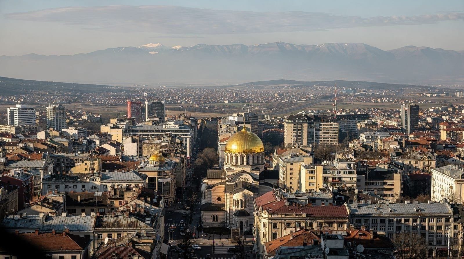
Vitosha is one of the defining features of Sofia — a 2290-metre mountain visible from almost every street corner, reachable on a city bus, and manageable in a single day without a car. For most visitors it is either the backdrop to every photo or the obvious answer to the question “what do I do for a day outside?” This guide covers both: what Vitosha actually is, how to get there under your own power, and which of its trails suits your fitness level and available time.
Getting there from Sofia
The standard route uses bus 93 or 98, both of which depart from Hladilnika metro station (Line 2, eastern branch). A single trip costs €0.80 and takes around 30 minutes to the Dragalevtsi trailhead. Buses run every 20–30 minutes from around 6am. There is no need to validate your ticket separately from the metro — a standard contactless fare covers the connection.
If you’re travelling with children, heavy packs, or simply prefer not to navigate public transport, a taxi from Sofia centre to Dragalevtsi costs €10–12 on the meter (always insist on the meter, or use Bolt or Yandex). Journey time is 15–20 minutes in normal traffic but can stretch to 30 minutes during rush hours.
A rental car gives flexibility, particularly if you want to access Boyana trailhead and Dragalevtsi on the same day. Parking at both is free but limited on weekend mornings in summer. Car rental in Sofia runs €30–50 per day. See getting around Sofia for a comparison of transport options.
GetYourGuideFrom Sofia: One-Day Tour of Vitosha MountainCheck availability →The main trailheads
Dragalevtsi
The most accessible trailhead and the starting point for the majority of visitors. The village of Dragalevtsi sits at around 760m, and from the bus terminus it is a 5-minute walk to the trail register and the base of the chairlift. From here, well-marked paths lead to Kumata hut (~1.5h), the ridge (~2.5h), and Cherni Vruh summit (~4–5h).
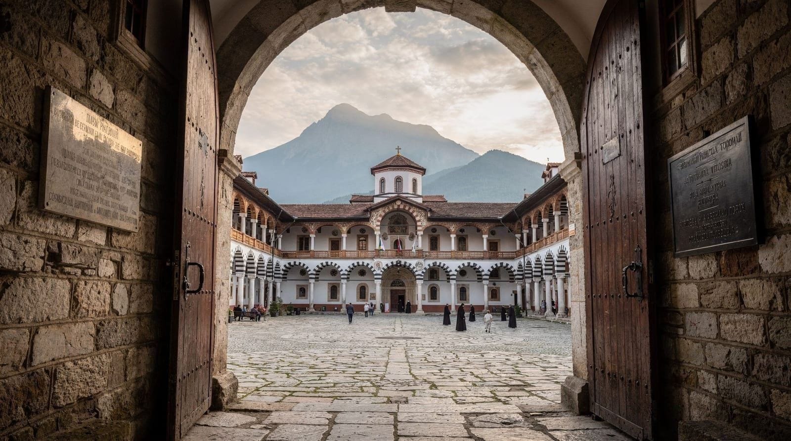
The Dragalevtsi Monastery is 15 minutes on foot from the trailhead along a signed path. Founded in the 14th century, the monastery church contains frescoes from the 15th century that survived multiple Ottoman-era closures. Entry is free and the monastery grounds are usually open during daylight hours. It is a worthwhile 30-minute detour at the start or end of your hike — the frescoes are well-preserved and the courtyard is quiet on weekdays.
Boyana
The Boyana trailhead is the departure point for Zlatni Mostove and Boyana Waterfall, and the location of the Vitosha Natural Park administration office where you can pick up a paper trail map (free). Boyana sits slightly lower than Dragalevtsi. Bus 64 from Hladilnika metro connects to Boyana, or a taxi from the Boyana Church area.
Simeonovo
The Simeonovo gondola — when operational — offers the fastest elevation gain, lifting you from around 830m to approximately 1800m in minutes. However, it has been frequently closed for maintenance or upgrade work. Before building a plan around the gondola, check the Vitosha Natural Park website or call the operations number. Do not rely on previous-year trip reports for current gondola status.
When the gondola is running, it typically operates from July through early September, usually 9:00–17:00. The base station is a short taxi ride from Simeonovo metro station.
The four main routes
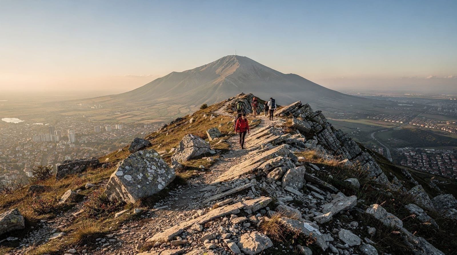
Cherni Vruh via Kumata hut — moderate to strenuous
Distance: ~10 km one way from Dragalevtsi. Elevation gain: ~1530m from trailhead to summit. Time: 4–5 hours ascent, 3 hours descent.
The route follows orange and yellow trail markers from Dragalevtsi through mixed beech forest, past Kumata hut (a mountain refuge with a basic café, usually open weekends in summer), and up the open ridge to the summit plateau. The final section from the ridge to Cherni Vruh crosses open terrain with no tree cover — wind can be significant here regardless of the weather lower down.
Cherni Vruh (2290m) has a weather station and a small stone shelter. On clear days the view extends south into the Rila and Rhodope ranges, and on unusually clear days westward to peaks in North Macedonia. The summit cross was erected in the 1930s. There is no café or refuge at the summit.
The descent by the same route takes less time but requires care on loose stone below the ridge. An alternative descent via Zlatni Mostove is possible with a map and adds roughly 45 minutes.
GetYourGuideFull-Day Vitosha and Cherni Vruh Peak Hiking TourCheck availability →Zlatni Mostove — easy
Distance: 4 km round trip from Boyana. Elevation gain: ~250m. Time: 1.5–2 hours.
Zlatni Mostove — “Golden Bridges” — is a periglacial stone river: a wide channel of angular boulders, some larger than a car, formed by freeze-thaw cycles over thousands of years. The path from Boyana trailhead is wide, clearly signed, and suitable for children and people with limited hiking experience. The stone river itself stretches roughly 800 metres along a shallow valley and is best appreciated by walking its length rather than viewing it from a distance.
The boulders are not a bridge in the architectural sense. The name comes from the golden lichen that covers many of the rocks, particularly visible in autumn and spring sunlight. The area is popular with families on weekends and often busy by 11am.
From Zlatni Mostove you can continue uphill toward the ridge (connecting to the Cherni Vruh route) or return to Boyana by the same path.
Kopitoto ridge via Darvenista — moderate
Distance: 7 km one way. Elevation gain: ~800m from Darvenista. Time: 2.5–3.5 hours up.
The Kopitoto area (around 1360m) sits on the lower ridge above Sofia and offers broad views over the city and the surrounding plain. The route from Darvenista follows a well-maintained forest road for the first third, then transitions to a rocky trail. Kopitoto itself has a telecommunications mast and a small rest area. The views are particularly clear after rain, when the Sofia smog has dispersed.
This is a good option if you want a ridge walk with city views without committing to the full Cherni Vruh ascent.
Boyana Waterfall — easy
Distance: 2.5 km round trip from Boyana. Elevation gain: ~100m. Time: under 1 hour.
A short trail from the Boyana trailhead leads to a tiered waterfall. Flow is highest in spring (April–May) from snowmelt. By August, flow is reduced but not dry. The path passes through beech forest and is shaded for most of its length. This is the right choice for families with young children or visitors with limited time.
Seasonal conditions
Summer (June–August)
Trails above 1800m are fully clear by mid-June. Weekend mornings on the Cherni Vruh trail are crowded — expect to share the trail with groups. Early starts (before 8am from the trailhead) solve this. Temperatures at the summit are typically 10–15°C cooler than in Sofia, so a mid-layer is always useful. Afternoon thunderstorms are common in July and August; start early and plan to be below the treeline by 2pm.
Autumn (September–October)
The most comfortable season for hiking Vitosha. Crowds thin significantly after the school year starts in September. Beech forest turns in October, providing good foliage across the lower slopes. Trails are firm and dry. Snow above 1800m is possible from mid-October.
Winter (November–March)
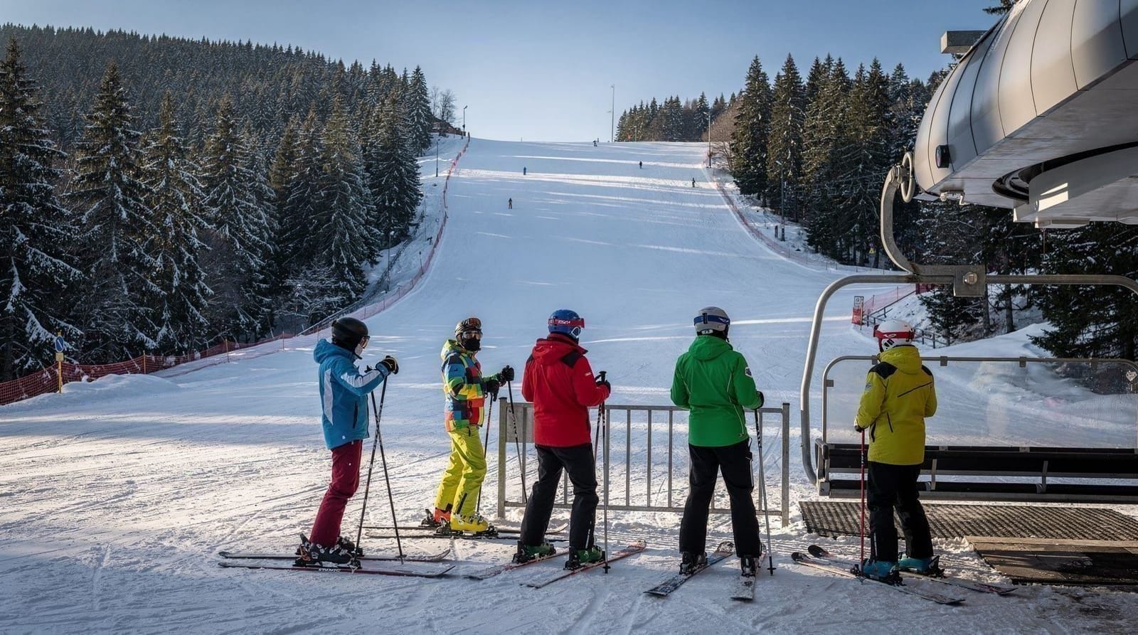
Vitosha in winter is heavily used by Sofia residents for snowshoeing, Nordic skiing, and winter walking. The Cherni Vruh route is accessible with snowshoes or micro-crampons from December through February. Trail markers are visible even under snow as the poles are tall. Expect shorter daylight: sunrise around 7:30am, sunset around 5pm in January.
GetYourGuideFrom Sofia: Snowshoe Hike on Vitosha MountainCheck availability →The Zlatni Mostove area is particularly atmospheric in winter, with snow between the boulders and minimal other visitors on weekdays.
Spring (March–May)
Snow lingers above 1800m through April and sometimes into early May. Trails below this altitude can be very muddy from snowmelt, particularly the Dragalevtsi–Kumata section. Waterproof boots are more important in spring than at any other time. The Boyana Waterfall trail is at its best in April when flow is highest.
What to bring
Footwear: Trail runners are adequate for Zlatni Mostove and Boyana Waterfall. For the Kopitoto ridge or Cherni Vruh route, proper ankle-supporting hiking boots are strongly recommended — the descent on loose stone is significantly more comfortable and safer with a stiff sole. In winter, add micro-crampons or snowshoes.
Clothing: The temperature differential between Sofia and Cherni Vruh summit can exceed 15°C. Bring a mid-layer (fleece or light down) and a waterproof shell regardless of the weather forecast. On the open ridge, wind chill makes effective temperature feel considerably lower than the thermometer reading.
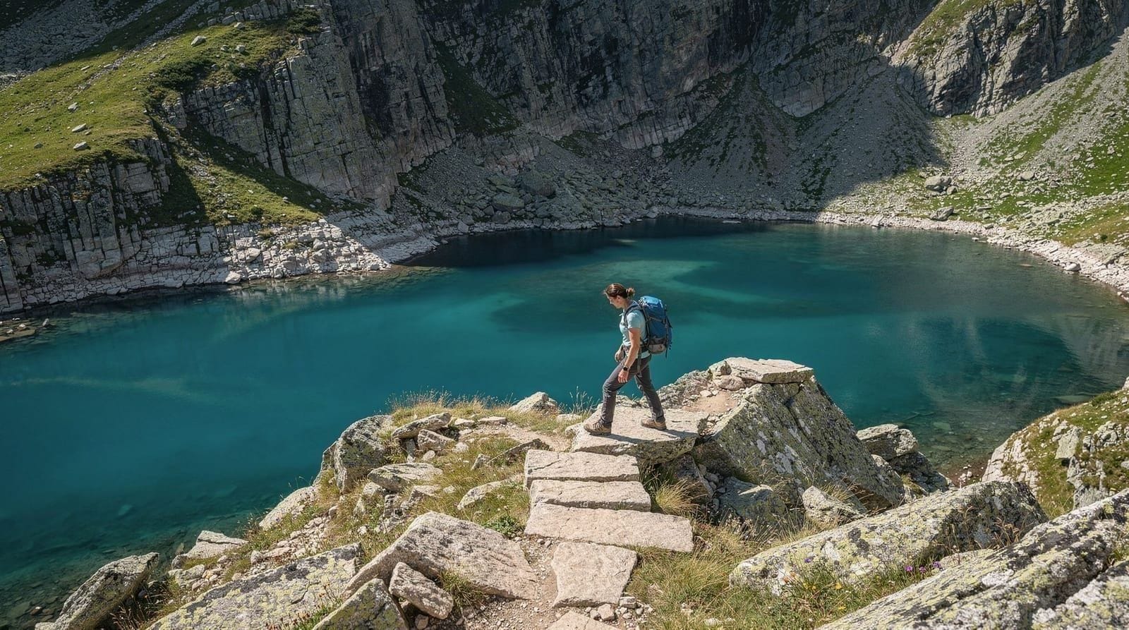
Water: There are no reliable water sources on the upper trails above Kumata hut. Carry at least 2 litres per person for the Cherni Vruh route. Kumata hut usually has water available when open, but do not depend on it.
Navigation: Mobile signal becomes unreliable above 1500m and disappears entirely on the summit plateau. Download an offline map — Mapy.cz covers Vitosha with good trail detail — before leaving Sofia. The Vitosha Natural Park administration also produces a paper map available at the Boyana trailhead office.
Sun protection: UV intensity is noticeably higher above 1800m. Sunscreen and sunglasses are not optional on the upper ridge, even on overcast days.
Park rules and wildlife
Vitosha Natural Park charges no entry fee and requires no permit for day hiking. The park rules that visitors most commonly overlook are: no fires outside designated areas, no camping without advance authorisation, and dogs on a lead at all times. Litter collection points are at the main trailheads; there are no bins on the upper trails.
Wildlife in Vitosha is present but rarely seen close up. Deer are the most frequently observed larger mammal, usually at dawn or dusk in the lower forest. Wild boar inhabit the lower slopes; they avoid humans but can be startled. More commonly visible are birds of prey — red kites and common buzzards are seen on the ridgeline. Short-eared owls occasionally appear on the summit plateau in winter.
Connecting to other destinations
Vitosha is the closest natural escape from Sofia, but it is part of a wider pattern of mountain hiking accessible as day trips. The Seven Rila Lakes hike is a more demanding and more dramatic full-day excursion 100km south. Borovets and Bansko are within reach for ski season. See day trips from Sofia for a full comparison, and best time to visit Sofia for seasonal planning across all options.
If you are planning your time in Sofia itself, the Sofia travel guide covers the essentials, and how many days in Sofia can help you decide how to allocate time between the city and the mountains.
Frequently asked questions about Vitosha Mountain hiking guide
How do I get to Vitosha Mountain from Sofia city center?
Take bus 93 or 98 from Hladilnika metro station (Line 2, east end of the line). Both buses stop at the Dragalevtsi chairlift base. The journey takes around 30 minutes and costs €0.80 with a single metro/bus ticket. Alternatively, a taxi or rideshare app (Bolt, Yandex) from the centre costs roughly €10–12 and takes 15–20 minutes depending on traffic.Do I need a permit or pay entry to hike in Vitosha?
No. Vitosha Natural Park has no entry fee and no permit requirement for day hiking on marked trails. Camping within the park is restricted and requires prior authorisation from the park administration. Dogs must be on a lead on all trails.How long does it take to hike to Cherni Vruh peak?
From the Dragalevtsi trailhead, allow 4–5 hours up to Cherni Vruh (2290m) via Kumata hut, and around 3 hours back down by the same route. Total round-trip time including a 30-minute break at the summit is typically 8–9 hours. Starting by 8am from Dragalevtsi gives you comfortable daylight margins year-round.Is Vitosha suitable for beginners?
Yes, for two of the four main routes. Zlatni Mostove (the stone river) from Boyana is an easy 2-hour walk on a wide path with minimal elevation gain — ideal for families and first-time hikers. The Boyana Waterfall trail is even shorter. Kopitoto via Darvenista is moderate and suits reasonably fit walkers. Cherni Vruh is moderate-strenuous and requires proper footwear and at least basic fitness.Can I hike Vitosha in winter?
Yes. Winter hiking on Vitosha is popular, particularly snowshoeing to Cherni Vruh and along the Zlatni Mostove plateau. Trails above 1500m typically have snow from December through March. For the Cherni Vruh route in winter, micro-crampons or snowshoes are strongly recommended. Avalanche risk is generally low on the marked tourist trails but increases off-trail after heavy snowfall.What is the best trailhead for first-time visitors?
Dragalevtsi is the most practical starting point: frequent bus connections from Sofia, a chairlift (seasonal), and clear trail markings to both Kumata hut and the ridge. The Boyana trailhead is better if you want to visit Zlatni Mostove or Boyana Waterfall and avoid crowds. Simeonovo (gondola) is the most convenient for higher-elevation access, but verify the gondola is running before you go.Is there altitude sickness risk on Vitosha?
Altitude sickness is not a meaningful risk on Vitosha. The summit of Cherni Vruh sits at 2290m — below the threshold where acclimatisation becomes necessary. Fit hikers from any starting altitude can reach the peak without symptoms. If you feel unusually short of breath, it is more likely physical exertion than altitude. The only risk factor is if you have an undiagnosed cardiac condition; consult a doctor before any strenuous hike.
Top experiences
Bookable activities with verified prices and instant confirmation on GetYourGuide.